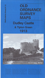
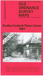
 Here are the details of maps for Dudley (North):

We have published two versions of this map, showing how the area changed across the years. They cover a busy industrial area, from Dudley Castle northward to the southern part of Tipton, and including much of the Tipton Green and Dudley Port areas.
Features include Dudley Castle, The Priory, Kettle's Hill, Castlemill Works, GWR Oxford Worcester & Wolverhampton railway with Dudley station, LNWR railway with Sedgley Junction, Birmingham Canal Wolverhampton Level, tramways, industrial tramways and sidings, Coneygree Iron Foundry, Tividal tram repair works, Portfield Works, Crown Iron Foundry, Hope Works, Model Sausage Factory, Tipton Green area, Victoria Park, Phoenix Foundry, Guest Hospital, Castle Field Pits, Coneygree Collieries, Dudley Canal, Burnt Tree area, many old collieries and coal shafts, industrial landscape.
The map links up with sheets 67.08 Tipton to the north, 67.11 Gornal to the west, 68.09 Greets Green to the east, 67.16 Dudley to the south.