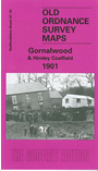
 Here are the details of maps for Gornalwood:

This detailed map covers the covers Gornalwood, and the area westward to Straits Green (in the centre of the map) and Himley Wood.
Features on the map include St John's church, chapels, Redhall, old coal shafts, Ruiton Farm, Ellowes Hall, brick works, Straits Green, Turner's Hill Wood, Turner's Hill, Wallows Wood, Gordon's Place, Straits House, Himley Colliery, Higharcal, mineral railway and tramway, Himley Wood etc. On the reverse we include a section of the Revision of 1913, showing the Himley Colliery area at a later date.
The map links up with sheets 67.06 Sedgley West to the north, 67.11 Gornal to the east, 67.14 Shut End to the south.