Old Ordnance Survey One-Inch Maps


These maps are taken from the famous OS "Inch to the Mile" Maps. Though obviously far less detailed than the large scale maps for which we are perhaps better known, they provide an invaluable overview of a wider area, typically 18 miles across by 12 miles down. For transport historians they are invaluable for showing old railways, while all historians need them for their close depiction of topography, including parish boundaries. These maps also mean that we can offer historical coverage for small villages where a large scale map would not be commercially viable. We intend to publish the whole of England and Wales in this series. Almost 200 titles are now available and we aim to publish three new titles each month. The maps include historical notes and almost all also include a large scale map of a small town or village in the area.

The maps are neatly folded and each includes a specially written introduction to the area. Maps can be purchased on our On-line Mapshop where further information about titles is given. Visit the One Inch Page for a full list of Inch to the Mile Maps, or The Index Page for a full list to the series and details of Prices.

Here is information about Sheet 202:

  • One Inch Sheet 202 Towcester & District 1899 - published 2003; introduction Barrie Trinder

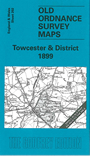
    This Inch to the Mile map covers the southern part of Northamptonshire, centred on Towcester; coverage stretches from Eydon and Woodford Halse eastward to Hanslop and Wolverton, and from Bugbrooke southward to Wiucken and Calverton. There is a small area of Buckinghamshire to the SE. The old Watling Street, the A5, runs through the map, and there is also a long stretch of the Grand Junction Canal. Railways include the Northampton & Banbury Jct, the Great Central, and the East & West Jct railways. Barrie Trinder explains how the lines centred on Towcester came to be the Stratford-on-Avon & Midland Junction Railway in 1909. On the reverse is a map of the centre of Blisworth, with directory.


    It is not possible to list the many hamlets, farmsteads and other topographical features shown on these maps. However, you may find it useful if we list the towns and principal villages or church parishes that are included on this map. Links are given for those for which detailed large-scale maps are also available.

  • Buckinghamshire: Biddlesden, Calverton, Castle Thorpe, Hanslope, Lillingstone Dayrell, Lillingstone Lovell, Stony Stratford, Wolverton.
  • Northamptonshire: Abthorpe, Adstone, Alderton, Ashton, Blakesley, Blisworth, Canons Ashby, Collingtree, Cosgrove, Courteenhall, Culworth, Eydon, Farthinghoe, Farthingstone, Fawsley, Grafton Regis, Great Everdon, Greatworth, Hackleton, Hardingstone, Hartwell, Heindon, Horton, Litchborough, Maidford, Marston St Lawrence, Milton, Moreton Pinkney, Passenham, Paulerspury, Piddington, Plumpton, Potterspury, Preston Capes, Radstone, Roade, Shutlanger, Silverstone, Slapton, Stoke Bruerne, Towcester, Wappenham, Weedon Lois, Weston, Whitfield, Whittlebury, Wicken, Woodend, Woodford Halse, Wootton, Yardley Gobion.

    For a full list of maps for the counties go to the Buckinghamshire or Northamptonshire pages.

    You can order maps direct from our On-line Mapshop. For other information and prices, and other areas, go to The Index Page.


    The Godfrey Edition / godfreyedition@btinternet.com / 22 January 2006