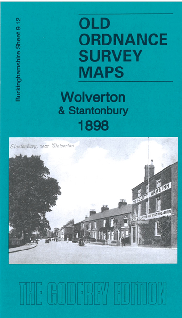
Old Ordnance Survey Maps of Wolverton


We have published more than 1,800 maps in our series of Old Ordnance Survey Map reprints, including a group in Buckinghamshire. The maps are highly detailed. They are taken from the OS 1:2,500 (or 25 inch) maps and reduced to about 15 inches to the mile. Each covers an area of a mile and a half by a mile. They show streets with individual houses, tram tracks, railway tracks and even signals, factories, wharves and such details as fountains and water troughs. They will provide hours of fascination for historians and genealogists. The maps are neatly folded and each includes a specially written introduction to the area. Maps can be purchased on our On-line Mapshop where further information about titles is given. Or visit The Index Page for a full list to the series and details of Prices.


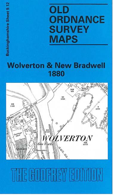
Here are the details of maps for Wolverton & New Bradwell:

  • Buckinghamshire Sheet 9.12 Wolverton & New Bradwell 1880 - published 1993; introduction by Moira Courtman

    This detailed map covers an area that is now at the northern end of Milton Keynes. Our main map covers the centre of the new railway town of Wolverton that had sprung up around the original station on the LNWR main line, including carriage shed and part of the carriage works. St George the Martyr's church is in the middle of the development. However, as Moira Courtman tells us, Wolverton was still suffering from the decision in 1864 to stop locomotive building and maintenance here and move it to Crewe. Many staff had to move north but this was more than compensated by others transferring to Wolverton from the Saltley carriage works, which was being run down. More space was needed for them and so New Bradwell was developed about half a mile to the east. Our map also includes this, including St James's church and station (on the Newport Pagnell branch). Other features include the Grand Junction Canal, Blue Bridge, Stonebridgehouse Farm, Corner Pin. By way of contrast, on the reverse we include more than half of the 1938 Revisaion, showing how the communities had developed. Striking here is he far more extensive railway layout, with the main line (now LMSR) diverted round to the east, with a new Wolverton station. As usual the fine detail (including tracks, signal posts etc) makes this fascinating to transport historians.

    For Old Wolverton go to the Stony Stratford map.

    You might find this index map useful.


    Follow this link for a complete list of our Buckinghamshire Series maps.

    You can order maps direct from our On-line Mapshop. For other information and prices, and other areas, go to The Index Page.


    Maps in the Godfrey Edition are taken from the 25 inch to the mile map and reduced to about 15 inches to the mile. For a full list of maps for the Buckinghamshire area, return to the Thames & Chilterns page

    The Godfrey Edition / godfreyedition@btinternet.com / 12 November 2005