Old Ordnance Survey Maps of Stony Stratford


We have published more than 1,800 maps in our series of Old Ordnance Survey Map reprints, including a group in Buckinghamshire & Northants. The maps are highly detailed. They are taken from the OS 1:2,500 (or 25 inch) maps and reduced to about 15 inches to the mile. Each covers an area of a mile and a half by a mile. They show streets with individual houses, tram tracks, railway tracks and even signals, factories, wharves and such details as fountains and water troughs. They will provide hours of fascination for historians and genealogists. The maps are neatly folded and each includes a specially written introduction to the area. Maps can be purchased on our On-line Mapshop where further information about titles is given. Or visit The Index Page for a full list to the series and details of Prices.


Here are the details of maps for Stony Stratford:

  • Buckinghamshire Sheet 9.10 Stony Stratford & Old Wolverton 1898 - published 1997; introduction by Alan Godfrey

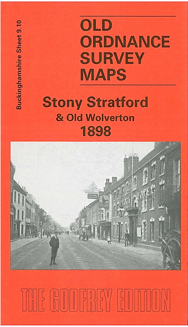
    This detailed map is split between two counties, Northamptonshire and Buckinghamshire. On the west side of the River Ouse is Old Stratford, historically part of Northants; this is here a small gathering of buildings, including the Swan Inn and Furtho House, on Watling Street; a major feature is the Buckingham Branch of the Grand Junction Canal. On the east of the river is the much larger Stony Stratford, which developed as a major town on Watling Street, later the A5. Features include St Paul's College, Market Square, High Street, Corn Mill, Ousebank, St Giles' church, St Mary's church, Watling Works, Calverton End (in SE corner of map). There is also the tramway depot of the steam trams to Wolverton. On the reverse we include a good section of the adjacent sheet 9.11 which extends coverage eastward to Old Wolverton, with Holy Trinity church, Wolverton Mill, Wolverton House, Locomotive Inn and Old Wolverton Wharf on the Grand Junction Canal. The tramway is shown along the main road.

    For 'New' Wolverton and the railway station area go to the Wolverton map.

    You might find this index map useful.


    Follow this link for a complete list of our Buckinghamshire Series maps or for our Northamptonshire maps.

    You can order maps direct from our On-line Mapshop. For other information and prices, and other areas, go to The Index Page.


    Maps in the Godfrey Edition are taken from the 25 inch to the mile map and reduced to about 15 inches to the mile. For a full list of maps for the Buckinghamshire area, return to the Thames & Chilterns page

    The Godfrey Edition / godfreyedition@btinternet.com / 22 January 2006.