Old Ordnance Survey One-Inch Maps


These maps are taken from the famous OS "Inch to the Mile" Maps. Though obviously far less detailed than the large scale maps for which we are perhaps better known, they provide an invaluable overview of a wider area, typically 18 miles across by 12 miles down. For transport historians they are invaluable for showing old railways, while all historians need them for their close depiction of topography, including parish boundaries. These maps also mean that we can offer historical coverage for small villages where a large scale map would not be commercially viable. We intend to publish the whole of England and Wales in this series. Almost 200 titles are now available and we aim to publish three new titles each month. The maps include historical notes and all (except the double-sided Tyneside title) also include a large scale map of a small town or village in the area.

The maps are neatly folded and each includes a specially written introduction to the area. Maps can be purchased on our On-line Mapshop where further information about titles is given. Visit the One Inch Page for a full list of Inch to the Mile Maps, or The Index Page for a full list to the series and details of Prices.

Here is information about Sheet 98:

  • One Inch Sheet 98 Stockport, Altrincham & NE Cheshire 1912 - published 2004; introduction by Chris Makepeace

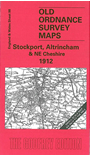
    This busy Inch to the Mile map is an ideal accompaniment to the growing range of detailed, large scale maps we have published for the Stockport and Trafford areas. It shows them in context. Coverage stretches from Lymm eastward to Marple and Compstall, and from Chorlton cum Hardy southward to Prestbury. On the reverse is a detailed map of Adlington Hall and Hollingsworth Smithy, including Adlington station. Ringway, much changed since the growth of Manchester Airport, is in the centre of the Inch to the Mile map.


    It is not possible to list the many hamlets, farmsteads and other topographical features shown on these maps. However, you may find it useful if we list the towns and principal villages or church parishes that are included on this map. Links are given for those for which detailed large-scale maps are also available.

  • Cheshire: Adlington, Alderley Edge, Altrincham, Ashley, Ashton upon Mersey, Baguley, Bollington, Bowdon, Carrington, Cheadle, Cheadle Hulme, Compstall, Dunham Massey, Hale, Handforth, Hazelgrove cum Bramhall, High Legh, Knutsford, Lostock Graham, Lymm, Marple, Mobberley, Nether Alderley, Northenden, Ollerton, Over Alderley, Pickmere, Pott Shrigley, Poynton with Worth, Prestbury, Rainow, Ringway, Romiley, Rostherne, Sale, Stockport, Styal, Tabley Inferior, Timperley, Toft, Warburton, Wilmslow, Woodford.
  • Lancashire: Heaton Norris, Withington.

    For a full list of Inch to the Mile maps go to the One Inch Page; or for Cheshire & Lancashire large scale maps go to the North West page.

    You can order maps direct from our On-line Mapshop. For other information and prices, and other areas, go to The Index Page.


    The Godfrey Edition / godfreyedition@btinternet.com / 23 December 2005