
 Here is information about Sheet 96:
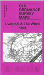
This busy and varied Inch to the Mile map covers most of the Wirral peninsula; in the top right corner is the city of Liverpool, while to the south west is a stretch of the Flintshire coastline on the Dee Estuary. Coverage stretches from the Point of Air eastward to Liverpool's Toxteth Park, and from New Brighton southward to Neston and Holywell. On the reverse we include a map of the Wirral Colliery area south of Neston.
It is not possible to list the many hamlets, farmsteads and other topographical features shown on these maps. However, you may find it useful if we list the towns and principal villages or church parishes that are included on this map. Links are given for those for which detailed large-scale maps are also available.
Index maps are available showing the areas covered by the Inch to the Mile maps. Go to This page
You can order maps direct from our On-line Mapshop. For a full list of Inch to the Mile maps go to the Inch to the Mile page, where you will also find details of prices. For information on the rest of the series, go to The Index Page.