Old Ordnance Survey Maps of Acton & Gunnersbury


We have published more than 2,100 maps in our series of Old Ordnance Survey Map reprints, some 300 of them in the London area. The maps are highly detailed. They are taken from the OS 1:2,500 (or 25 inch) maps and reduced to about 15 inches to the mile. They show streets with individual houses, tram tracks, railway tracks and even signals, factories, wharves and such details as fountains and water troughs. They will provide hours of fascination for historians and genealogists. The maps are neatly folded and each includes a specially written introduction to the area. Maps can be purchased on our On-line Mapshop where further information about titles is given. For other information and Prices, see Index Page.


Here are the details of maps for Acton & Gunnersbury:
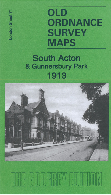
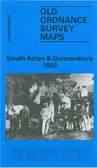
  • London Sheet 71.2 South Acton & Gunnersbury 1893 - published 1990; introduction by Pamela Taylor
  • London Sheet 71.4 South Acton & Gunnersbury Park 1935 - published 1990; introduction by Jonathan Oates

    We have published two versions of this map so far; each covers the same area, so you can see how the streets chanmged over the years. The western half of the map is dominated by Gunnersbury Park, including Gunnersbury House. The eastern half of the map is very built up, with South Acton, the Mill Hill Park estate and, further down, Acton Green. Acton High Street is in the NE corner. Several railways cross the map, including the North & South Western Junction and the District's Ealing Extension. Stations include South Acton, Chiswick Park & Acton Green, and Mill Hill Park (later Acton Town). Other features include Fairlawn House, All Saints church, Bollo Bridge Road, Heathfield Lodge, Berrymead Priory (here Constitutional Club), Elm Grove (until 1892 the Royal India Asylum). St Mary's parish church is at the extreme top of the map. The 1935 version includes a selection of contemporary street directories for Avenue Road, Bollo Bridge Road, Gunnersbnury Avenue, Gunnersbury Lane, Osborne Road.

    An index map showing the areas covered by this and adjacent maps is available here. 
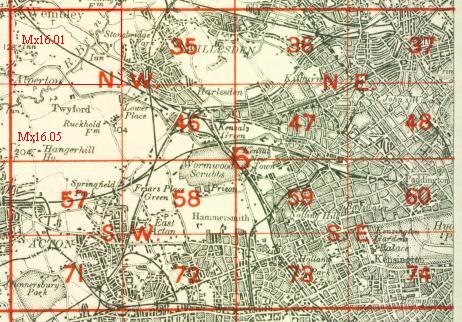
The map links up with London Sheets 57 Ealing Common to the north, 70 South Ealing to the west, 72 North Hammersmith to the east, and 84 Kew to the south.


    Follow this link for a complete list of our London maps .

    You can order maps direct from our On-line Mapshop. For other information and Prices, see Index Page.


    Maps in the Godfrey Edition are taken from the 25 inch to the mile map and reduced to about 15 inches to the mile. For a full list of maps for London, return to the London page.

    The Godfrey Edition / godfreyedition@btinternet.com / 25 January 2008