Old Ordnance Survey Maps of Acton Town


We have published more than 2,000 maps in our series of Old Ordnance Survey Map reprints, some 300 of them in the London area. The maps are highly detailed. They are taken from the OS 1:2,500 (or 25 inch) maps and reduced to about 15 inches to the mile. They show streets with individual houses, tram tracks, railway tracks and even signals, factories, wharves and such details as fountains and water troughs. They will provide hours of fascination for historians and genealogists. The maps are neatly folded and each includes a specially written introduction to the area. Maps can be purchased on our On-line Mapshop where further information about titles is given. For other information and Prices, see Index Page.


Here are the details of maps for Acton Town:

  • London Sheet 57.1 Acton Town & Ealing Common 1864 - published 1990; introduction by Pamela Taylor
  • London Sheet 57.2 Ealing Common & West Acton 1894 - published 2005; intro by Jonathan Oates
  • London Sheet 57.4 Ealing Common & West Acton 1934 - published 2007; intro by Jonathan Oates

    We have published three versions of this map, showing how the area developed across the years. All maps show the same area, in great detail, including indivdual houses. Coverage stretches from Haven Lane Ealing eastward to Myrtle Road Acton. The eastern part of Ealing is shown, including St Matthew's church, Ealing Common, Ealing Common & West Acton station, Hanger Hill Farm, Hanger Vale; the western part of Acton is also shown, features here including Springfield Park, Steyne Mills, The Elms, The Steyne, The Lodge, Churchfield Road West, Horn Lane. The earlier map shows the area before the railway arrived, when much of the map was rural.

    The 1894 map includes a selection of street directory entries on the reverse, including Chaucer Road, Grange Park/Road, Hamilton Road, Horn Lane, Inglis Road, Madeley Road, North Common Road, Spencer Road, Steyne Road. On the reverse of the 1864 map we include five-foot plan 6.61 (reduced to 24" to the mile) covering the area around Hamilton Road and the north part of Ealing Common in 1891. On the reverse of the 1934 map we include a selection of street directory entries.

    An index map showing the areas covered by this and adjacent maps is available here. 
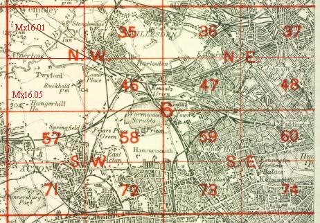
The map links up with London Sheets 56 Ealing to the west, 58 East Acton to the east, 71 South Acton to the south and Middlesex Sheet16.05 Hanger Hill to the north.


    Follow this link for a complete list of our London maps .

    You can order maps direct from our On-line Mapshop. For other information and prices, and other areas, go to The Index Page.


    Maps in the Godfrey Edition are taken from the 25 inch to the mile map and reduced to about 15 inches to the mile. For a full list of maps for England, return to the England page.

    Alan Godfrey Maps, Prospect Business Park, Leadgate, Consett, Co Durham, DH8 7PW / sales@alangodfreymaps.co.uk / 25 January 2008