
 Here are the details of maps for Kensal Green:

We have published four versions of this map, showing how the area developed across the years, becoming progressively more built up. The maps each cover the same area, with Kensal Green on the west side of the map, west Kilburn to the east, and Kensal New Town near the foot of the map. Stretches of the Hampstead Junction, LNWR and GWR railway lines and the Grand Junction Canal run through the map. On the 1865 version there is little development apart from Kensal New Town, buildings along Kensal Road, part of Westbourne Green in the extreme SE corner, and early west Kilburn streets around Canterbury Road. Near the centre of the map is Chamberlain Wood Farm. Each map shows All Souls (or Kensal Green) Cemetery. The later maps are much more built up, with solid streets of housing between Kensal New Town and the LNWR railway, including Harrow Road, Kilburn Lane, Shirland Road and many more. Other features include gasworks, carriage sheds, Queen's Park, Queen's Park station. On the 1913 map Kensal Rise, north of the LNWR is also built up. The 1935 map includes the car factory for Talbot cars. The three later maps include extracts from street directories. The 1865 map includes a description of the cemetery from Walford's Old & New London.
The map links up with London Sheets 36 Willesden Green to the north, 46 Willesden Junction to the west, 48 St Johns Wood to the east, and 59 Notting Hill to the south.
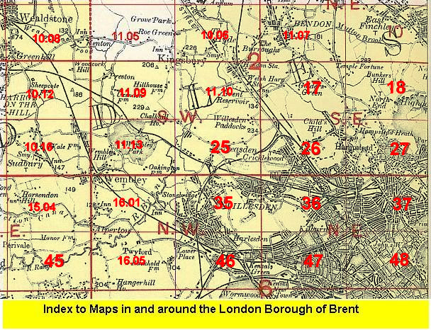 Follow this link for a list of our maps for the London Borough of Brent, or here for a complete list of our London maps .