
 Here is information about the map for Hanworth Park:

We have published just the one version of this map. This catches the area at the peak of its fame, when the London Air Park was thriving. This airport was twice visited by the Graf Zeppelin, and survived until 1947, by which time it was too close to the expanding Heathrow. The map includes the Air Park, and the area east towards New Hanworth, and north towards the SR Windsor line, of which just a small section is shown. The map is crossed diagonally by Hampton Road, becoming Uxbridge Road, and other roads include Hounslow Road, Waverley Avenue, Twickenham Road. Other features include farms and nurseries, while the River Crane meanders through the map. There is a directory of Hanworth on the back, together with a very informative history of the area by Tony Painter.
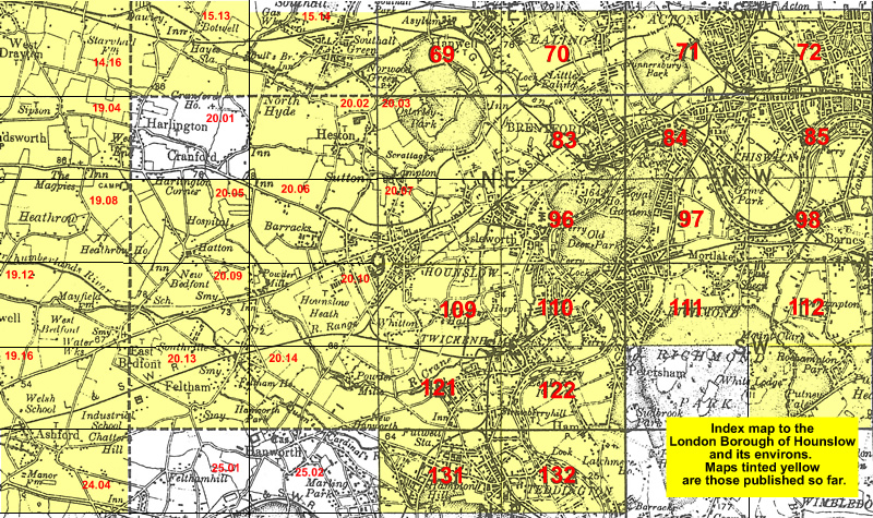
The map links up with Middlesex Sheet 20.10 Hounslow Heath to the north and 25.02 Hanworth to the south. 20.10 Feltham to the west and London Sheet 121 West Twickenham to the east.
 Follow this link for a list of our maps for the London Borough of Hounslow, or here for a complete list of our London maps .