 Old Ordnance Survey Maps for CaernarvonshireOld Ordnance Survey Maps for Caernarvonshire
 These are our maps for Caernarvonshire:
All maps are available from our On-line Mapshop or from selected bookshops in the area.
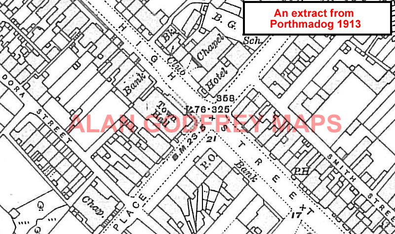
The following maps are taken from the OS 25" maps and reduced to a scale of approximately 15 inches to the mile. They are extremely detailed, showing individual houses, details such as railway tracks, pathways, pubs, factories and even minutiae such as fountains and signal posts. Most maps cover an area of a mile by a mile and a half.
 These are our maps for towns in Caernarvonshire:
 We also publish a series of Inch to the Mile maps. These are the principal sheets for Caernarvonshire:
Visit the One Inch page for full details of this series.
