
 Here is information about Sheet 118:
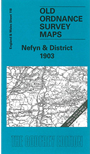
This Inch to the Mile map covers the northern part of the Llyn Peninsula. Coverage stretches from Nevin (or Nefyn) and Porth Dinllaen eastward to Criccieth, and northward to Llanwrog. Features include Yr Eifel, Bwlch Mawr, Mynydd Craig-goch, the Caernarvonshire Branch railway, and industrial railways around Nantlle. On the reverse we include a detailed map of Nevin itself, an extract from Caernarvonshire Sheet 32.09 of 1914
It is not possible to list the many hamlets, farmsteads and other topographical features shown on these maps. However, you may find it useful if we list the towns and principal villages or church parishes that are included on this map. Links are given for those for which detailed large-scale maps are also available.
For a full list of maps for Caernarvonshire go to the Caernarvonshire page; or to the Wales page for a full list for the country.
Index maps are available showing the areas covered by the Inch to the Mile maps. Go to This page
You can order maps direct from our On-line Mapshop. For a full list of Inch to the Mile maps go to the Inch to the Mile page, where you will also find details of prices. For information on the rest of the series, go to The Index Page.