
 Here is information about Sheet 94:
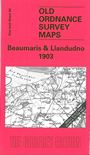
This map covers the north Wales coast from east Anglesey across to Great Ormes Head, across Conway Bay. Coverage stretches from Red Wharf Bay (including Red Wharf station) eastward to Llandudno and Llandudno Junction. Other towns shown are Beaumaris, Conway and Penmaenmawr. Inevitably, rather a lot of the map is sea (the map only goes as far south as Beaumaris), but we provide added interest on the back by providing an extract from Anglesey Sheet 15.13, for Beaumaris in 1913, including its great castle.
It is not possible to list the many hamlets, farmsteads and other topographical features shown on these maps. However, you may find it useful if we list the towns and principal villages or church parishes that are included on this map. Links are given for those for which detailed large-scale maps are also available.
Index maps are available showing the areas covered by the Inch to the Mile maps. Go to This page
You can order maps direct from our On-line Mapshop. For a full list of Inch to the Mile maps go to the Inch to the Mile page, where you will also find details of prices. For information on the rest of the series, go to The Index Page.