Old Ordnance Survey Maps of Bristol
We have a range of detailed maps for Bristol and we also cover the whole county at the Inch to the Mile scale.
All maps are available from our On-line Mapshop.
Bristol has been a county in its own right since 1373 and in 1889 became a county borough. In 1974 it became part of the County of Avon.
However, Avon was abolished in 1996 and Bristol is now a unitary authority. Some of the northern suburbs are in South Gloucestershire, which is also a unitary authority. Those
maps are included here too.
See This Page for a summary of the county's local government history.
 These are the maps we publish for Bristol:
For the Portishead and Clevedon area see the North Somerset page; for the Bath area see the Bath & NE Somerset page.
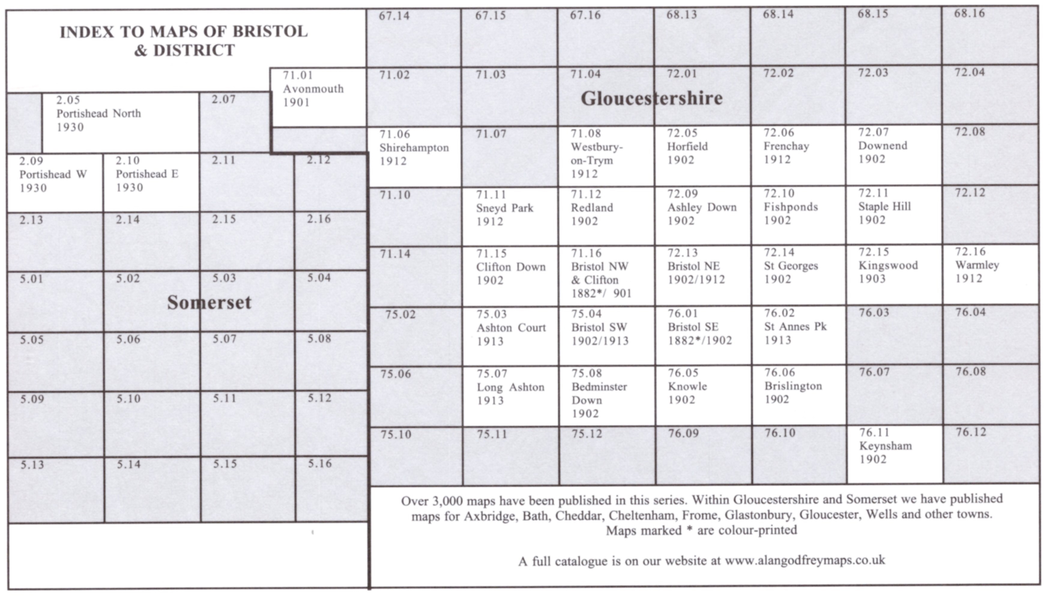
Here is an Index Map to the Bristol maps.
 Most maps in the Godfrey Edition are taken from the 25 inch to the mile map and reduced to about 15 inches to the mile.
For a full list of English maps, return to the England page
You can order maps direct from our On-line Mapshop.
Most maps in the Godfrey Edition are taken from the 25 inch to the mile map and reduced to about 15 inches to the mile.
For a full list of English maps, return to the England page
You can order maps direct from our On-line Mapshop.
Alan Godfrey Maps, Prospect Business Park, Leadgate, Consett, DH8 7PW. Tel 01207 583388
The Godfrey Edition / sales@alangodfreymaps.co.uk / 11 December 2020
 These are the maps we publish for Bristol:
