
 Here are the details of maps for Westbury-on-Trym

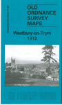
This detailed map covers the village of Westbury-on-Trym, north of Bristol. Features include Royal School for the Blind, Eastfield area, Henlease Park, Henley Grove, part of Henleaze, Cote House, Convent of Mercy, Red Maids School, Eastfield House, Holy Trinity church, tramway, Westbury Court Farm, Cotebank, The Priory, Golden Hill, Horfield Common, Holy Trinity church Horfield etc. An 1894 directory of Westbury is included on the reverse.
The map links up with sheets 72.05 Horfield to the east, 71.12 Redland to the south.
Maps in the Godfrey Edition are taken from the 25 inch to the mile map and reduced to about 15 inches to the mile. For a full list of maps for England, return to the England page.
Alan Godfrey Maps, Prospect Business Park, Leadgate, Consett, Co Durham, DH8 7PW / sales@alangodfreymaps.co.uk / 28 October 2016