
 Here are the details of maps for Sneyd Park:

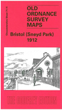
This detailed map covers the Sneyd Park area NW of Bristol. Most of Sneyd Park is covered, including Rockleaze, Downleaze, Stoke House, several villas, Old Sneed Park, Seamills, railway with Sea Mills station, River Avon with part of GWR Portishead Branch. On the reverse we include a directory of Stoke Bishop plus timetables for the Bristol to Avonmouth Dock line.
The map links up with sheets 71.12 Redland to the east and 71.15 Clifton Down to the south.
Maps in the Godfrey Edition are taken from the 25 inch to the mile map and reduced to about 15 inches to the mile. For a full list of maps for England, return to the England page.
Alan Godfrey Maps, Prospect Business Park, Leadgate, Consett, Co Durham, DH8 7PW / sales@alangodfreymaps.co.uk / 28 October 2016