
 Here are the details of maps for Conham:

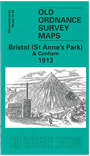
This detailed map covers an area to the east of Bristol, with coverage stretching from the St Anne's Park area eastward to Conham, Jefferies Hill and the western part of Hanham (junction of Jefferies Hill and Hanham Street is at eastern edge of map). Features include St Anne's Park station, Wick House, River Avon, Conham, Conham Hall, Tar & Rosin Works, quarries, New Brislington Bridge, Hanham Colliery with tramway to river, Jefferies Hill, Christ Church, boot factory, Hanham Street etc. On the reverse we include directories of Brislington and Hanham.
The map links up with sheets 72.14 St Georges to the north, 76.01 Bristol SE to the west and 76.06 Brislington to the south.
Maps in the Godfrey Edition are taken from the 25 inch to the mile map and reduced to about 15 inches to the mile. For a full list of maps for England, return to the England page.
Alan Godfrey Maps, Prospect Business Park, Leadgate, Consett, Co Durham, DH8 7PW / sales@alangodfreymaps.co.uk / 28 October 2016