Old Ordnance Survey Maps of Breconshire
We have a range of detailed maps for towns and villages in Breconshire or Brecknockshire, and we also cover the whole county at the Inch to the Mile scale. Here are the details.
The following maps are all taken from the OS 25" maps and reduced to a scale of approximately 15 inches to the mile.
They are extremely detailed, showing individual houses, details such as railway tracks, pathways,
pubs, factories and even minutiae such as fountains and signal posts. Each map includes an introduction.
All maps are available from our On-line Mapshop.
For a summary of the county's administrative history go to This Page.
 These are the maps we publish in Brecknockshire:
 We are also publishing a series of Inch to the Mile maps, which now cover
the whole of Wales. Visit the One Inch page for full details and index maps; the following are the principal sheets for Brecknockshire:
We are also publishing a series of Inch to the Mile maps, which now cover
the whole of Wales. Visit the One Inch page for full details and index maps; the following are the principal sheets for Brecknockshire:
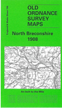
- 196 North Breconshire 1908 - published 2003, intro by Edward Parry. Covers area around Builth and Llanwrtyd Wells. Includes a
map of Newbridge on Wye.
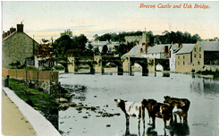
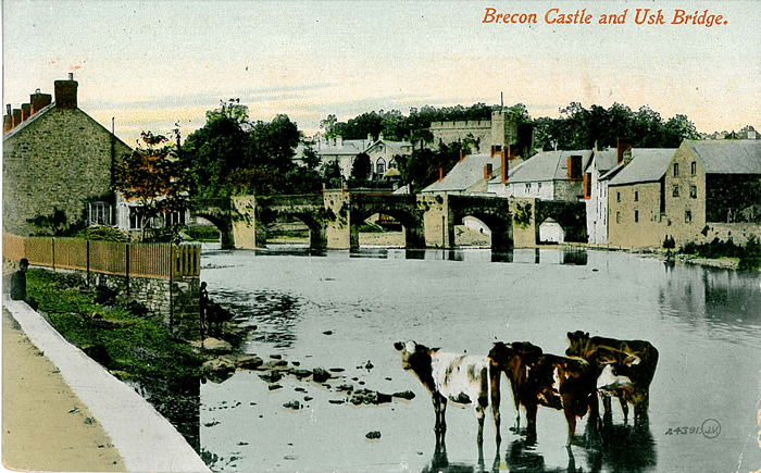
- 213 Brecon & District 1909 - published 2002, intro by Edward Parry. Area around Brecon and upper reaches of the
River Usk. Includes a map of Trecastle.
- 214 The Black Mountains 1909 - published 2003; intro by Edward Parry. Covers area around Llanthony, Vowchurch, Talgarth. Includes
a detailed map of Talgarth.
- 231 Merthyr & District 1908 - published 2006; intro by Derrick Pratt. Includes a map of Ystradfellte.
- 232 NW Monmouthshire 1914 - published 2007; intro by Derrick Pratt. Includes a map of Llechryd.
 Most maps in the Godfrey Edition are taken from the 25 inch to the mile map and reduced to about 15 inches to the mile.
For a full list of Welsh maps, return to the Wales page
You can order maps direct from our On-line Mapshop.
Most maps in the Godfrey Edition are taken from the 25 inch to the mile map and reduced to about 15 inches to the mile.
For a full list of Welsh maps, return to the Wales page
You can order maps direct from our On-line Mapshop.
Alan Godfrey Maps, Prospect Business Park, Leadgate, Consett, DH8 7PW. Tel 01207 583388
The Godfrey Edition / sales@alangodfreymaps.co.uk / 27 July 2018
 These are the maps we publish in Brecknockshire: