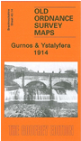
 Brecknockshire Sheet 43.14 Gurnos & Ystalyfera 1914 - published 2009; intro by Derrick Pratt. ISBN.978-1-84784-221-3
This detailed map covers an area divided between Brecknockshire and Glamorgan. It covers the area from the eastern part of Ystalyfera eastward to Ystradgynlais station and colliery. Features include the Swansea Canal with aqueduct, Gurnos, Neath & Brecon Railway with Ystragynlais station, Maes-y-dderwen school, Diamond Colliery, River Tawe, Glan-Tawe, Clyngwyn, MR Swansea Vale railway with Gurnos Junction, Yniscedwyn Branches, engine shed etc. Numerous mineral lines etc. Part of Ystalyfera itself is shown around Gurnos Road. On the reverse we include directories of Ystyfera and Gurnos.