Old Ordnance Survey Maps of Brecon


We have published more than 2,200 maps in our series of Old Ordnance Survey Map reprints, including a small group in Brecknockshire. The maps are highly detailed. They are taken from the OS 1:2,500 (or 25 inch) maps and reduced to about 15 inches to the mile. Each covers an area of a mile and a half by a mile. They show streets with individual houses, tram tracks, railway tracks and even signals, factories, wharves and such details as fountains and water troughs. They will provide hours of fascination for historians and genealogists. The maps are neatly folded and each includes a specially written introduction to the area. Maps can be purchased on our On-line Mapshop where further information about titles is given. Or visit The Index Page for a full list to the series and details of Prices.


  • Brecknockshire Sheet 28.13 Brecon 1903 - published 1996; introduction by Edward Parry

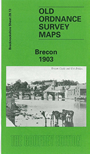
    This detailed map of Brecon is double-sided for maximum coverage. The main map covers the central area of the town, with coverage extending southward to Peny-lan and the River Usk. Features include the railway with station, goods depot, engine shed; St Mary's church, Dinas, Christ College, Bridge Street, Ship Street, Shire Hall, High Street, Infantry Barracks, Cattle Market, Congregational Memorial College, etc. On the reverse we include part of adjacent sheet 28.08 extending coverage northward to include Priory Church, castle remains, Market House, Pendre, Nythfa, and area up to Furnace Gate.


    Follow this link for a complete list of our Brecknockshire Series maps.

    You can order maps direct from our On-line Mapshop. For other information and prices, and other areas, go to The Index Page.


    Maps in the Godfrey Edition are taken from the 25 inch to the mile map and reduced to about 15 inches to the mile. For a full list of maps for Wales, return to the Wales page.

    The Godfrey Edition / godfreyedition@btinternet.com / 20 January 2009