Old Ordnance Survey One-Inch Maps


These maps are taken from the famous OS "Inch to the Mile" Maps. Though obviously far less detailed than the large scale maps for which we are perhaps better known, they provide an invaluable overview of a wider area, typically 18 miles across by 12 miles down. For transport historians they are invaluable for showing old railways, while all historians need them for their close depiction of topography, including parish boundaries. These maps also mean that we can offer historical coverage for small villages where a large scale map would not be commercially viable. We intend to publish the whole of England and Wales in this series. Almost 200 titles are now available and we aim to publish three new titles each month. The maps include historical notes and all (except the double-sided Tyneside title) also include a large scale map of a small town or village in the area.

The maps are neatly folded and each includes a specially written introduction to the area. Maps can be purchased on our On-line Mapshop where further information about titles is given. Visit the One Inch Page for a full list of Inch to the Mile Maps, or The Index Page for a full list to the series and details of Prices.

Here is information about Sheet 196:

  • One Inch Sheet 196 North Breconshire 1908 - published 2003; introduction by Edward Parry

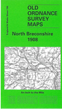
    This Inch to the Mile map covers the northern part of Breconshire or Brecknockshire. Coverage stretches from Mynydd Trawsnant and Cefn Coch eastward to Gwenddwr and Altmawr, and from Newbridge on Wye southward to Llandulas. The map is dominated by high moorland, while two railways run largely through the valleys, the Central Wales line and the Cambrian's Mid Wales line, the two crossing at Builth Road. The only towns are the small spa towns of Builth Wells and Llanwrtyd Wells; a third spa, Llangammarch Wells, was only regarded as a village by the OS. On the back we include an extract from Radnorshire Sheet 27.03 covering the village of Newbridge on Wye in 1902.

    It is not possible to list the many hamlets, farmsteads and other topographical features shown on these maps. However, you may find it useful if we list the towns and principal villages or church parishes that are included on this map. Links are given for those for which detailed large-scale maps are also available.

  • Brecknockshire: Abergwesyn, Altmawr, Builth Wells, Gwenddwr, Llanafan-fawr, Llanafan-fechan, Llanddewi'r-Cwm, Llandulas, Llanfihangel-Bryn-Tabuan, Llangammarch Wells, Llanganten, Llanlleonfel, Llanwrtyd Wells, Llanynis, Maesmynis.
  • Radnorshire: Aberedw, Disserth, Llanelwedd, Llanfaredd, Newbridge on Wye.

    For a full list of maps for the counties go to the Breconshire or Radnorshire pages; or to the Wales page for a full list for the country.

    You can order maps direct from our On-line Mapshop. For other information and prices, and other areas, go to The Index Page.


    The Godfrey Edition / godfreyedition@btinternet.com / 16 January 2006