Old Ordnance Survey Maps of Northumberland

  • These detailed maps normally cover an area of about one and a half miles by one mile. Each map includes an introduction.
  • They are available through our On-line Mapshop

  • Here are the details of maps for Seaton Delaval:

  • Northumberland Sheet 78.14 Seaton Delaval 1920 - published 2023; intro by Alan Godfrey. ISBN.978-1-78721-633-4

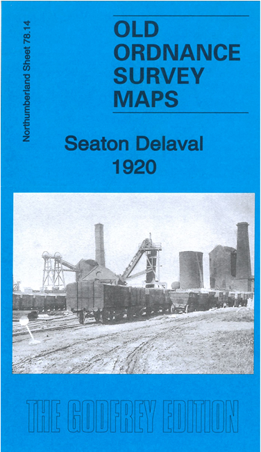
    This detailed map covers the colliery village of Seaton Delaval.

    Features include Seaton Delaval Colliery, pumping station, NER Blyth & Tyne railway with station, Forster Pit Branch, New Hartley Colliery Railway, East Cramlington, Cramlington Colliery Lamb Pit, Cramlington Colliery Railway, St Stephen's church, Wheatridge Farm, Miners Hall, Colliery Institute, long rows of miners' cottages, Astley Arms etc.

  • The map links up with sheets 78.13 Cramlington to the west and 86.02 Seghill to the south.
  • Follow this link for a complete list of our Northumberland maps. For other information and prices, and other areas, go to The Index Page.
  • Maps in the Godfrey Edition are taken from the 25 inch to the mile map and reduced to about 15 inches to the mile. For a full list of maps for the North East, return to the North East page.
    The Godfrey Edition / sales@alangodfreymaps.co.uk / 4 April 2023