
H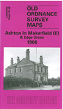 ere are the details of maps for Ashton (East):

This highly detailed map covers the eastern part of Ashton in Makerfield, now part of Wigan MBC. Coverage stretches from Town Green and York Road eastward to Dam Lane and Edge Green Colliery. Features include the eastern part of Ashton, incl Record Cotton Mill, Town Green Farm, Cookson's Farm, Bolton Road and tramway. Further east the map includes Golborne Road, Edge Green Colliery, a stretch of the GCR St Helen's Branch, Garswood Hall Collieries Shaft 9, Harrow Hotel, and several mineral lines around Edge Green. On the reverse we include a list of private residents in Ashton from a 1918 directory.
The map links up with sheets 101.04 Bamfurlong to the north, 101.07 Ashton in Makerfield to the west, 101.12 Haydock Park to the south, 102.05 Byrom Hall to the east.