
 Here are the details of maps for Ashton in Makerfield:

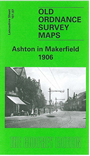
This highly detailed map covers most of the small town of Ashton in Makerfield, once an urban district but today part of Wigan MBC. Features include St Thomas church, St Oswald RC church, Market, tramways, St Oswald's Schools, Town Bridge, Jubilee Parks, Old Road, Garswood Hall Colliery Institute, Home Farm, Garswood Hall, Barrow Lane Colliery, Coverage extends west to Park Collieries, the LNWR Lancashuire Union Line with Garswood station (at margin of map), Birchenheds Colliery, Hinge & Lock Factory, Ashton Cross, etc. On the reverse we include a timetable for the Liverpool-Wigan line.
The map links up with sheets 101.08 Ashton (E) to the east and 101.11 Haydock North to the south..