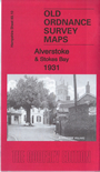
 Here are the details of maps for Alverstoke and Gosport:

This detailed map is double-sided for maximum coverage. It includes several detailed military features.
The main map covers Alverstoke village and the southern part of Gosport. Features include: Gosport Park, Poor Law Institution, Newtown area, Christ Church, Workhouse Lake, Haslar Royal Naval Cemetery, Stoke Lake, Anglesey area, Little Anglesey Viaduct, Clayhall, War Memorial Hospital, Alverstoke village, St Mary's church, St Mark's church remains, Stokes Bay Lines, Battery No.4, Bury Hall, Privett, Oval Gardens, Privett Place.
On the reverse we include adjacent sheet 83.14, extending coverage southward to include Gilkicker Point, Fort Monckton, Monckton Hutments, Royal Naval Camp, Admiralty Signal Station, School of Electric Lighting, Stokes Bay Pier, disused railway, Fort Gilkicker, Monckton House.
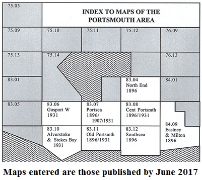
The map links up with Hampshire Sheets 83.06 Gosport West to the north, 83.11 Old Portsmouth to the east.
You might find this Index Map useful.