Old Ordnance Survey Maps of Edinburgh

  • This map is taken from the original OS 1:1056 or 'Five'foot' plan and reduced to a scale of A Yard to the Mile. It shows the area in great detail, including the interiors of some public buildings. On the reverse we include a 1:500 map from the 1890s, here reduced in scale, showing part of the area at a later stage, together with a 2,000 word introduction to the history of the area.
  • They are available through our On-line Mapshop

  • Here are the details of our map for Holyrood and Abbeyhill:

  • Edinburgh 31 Edinburgh: Holyrood & Abbeyhill 1877 - published 2025; intro by Alan Godfrey. ISBN.978-1-78721-863-5

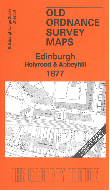
    This highly detailed map covers the area from Holyrood Palace and Abbey Mount eastward to Meadowbank. Features include Holyrood Palace, St Ann's Brewery, Croft an Righ Brewery, Palace Brewery, Heriot's School, malthouses, North British Railway with Abbeyhill Junction, St Margaret's Loch, etc.

    On the reverse we include 1:500 sheet III.8.8 covering Croft an Righ and the northern part of Holyrood Palace at a later date..

    The map links up sheet 30 Calton Hill to the west and 32 Jock's Lodge to the east.


  • Follow this link for a complete list of our Edinburgh maps. For other information and prices, and other areas, go to The Index Page.
  • This map is taken from the 5-foot plan and reduced to a scale of a Yard to the Mile. For a full list of maps for Scotland, return to the Scotland page.
    The Godfrey Edition / sales@alangodfreymaps.co.uk / 13 June 2025