
 Here are the details of maps for Edinburgh (New Town):

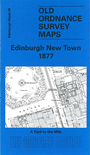
This extremely detailed map covers part of the Princes Street and New Town area of Edinburgh. Coverage stretches from Castle Street eastward to St James Square, and from Waverley Station northward to Abercromby Place.
Features include most of Waverley station, Waverley Market, General Register House, New Register House, Royal Institution, Commercial Bank, New Club House, Assembly Rooms, General Post Office, St Andrew's church, Clydesdale Bank, National Bank, British Linen Company's Bank and for most of these even internal features are given. Other features binclude tramways, East Princes Street Gardens, Scott Monument, St Andrew Square, Queen Street Gardens, George Street, Music Hall, etc. On the reverse we include 1851 street directory entries for Frederick Street, George Street, Queen Street and St Andrew Street.
The map links up sheet 28 Dean Village to the west, 30 Calton Hill to the east and 35 Edinburgh Castle to the south.