 Here are the details of maps for Wick:

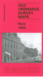
This detailed map covers the busy port of Wick, from which over 1,100 fishing vessels operated by the 1860s. Most of the town centre is shown, and coverage stretches from Huddart Street westward to Gauliquoy, and from Louisburgh Street southward to the cemetery. Features include the railway with station, incl a section of the Wick & Lybster Light Railway; Lower Pulteneytown, Inner Harbour, part of Outer Harbour, Pulteney Distillery, Bridge of Wick, Taits Harbour, Sillersburn, Langley Park, East Banks, churches, High Street, Janetstown, Academy, Harrow Mill, and the town centre shown in detail, with individual buildings neatly delineated. Extracts from a contemporary trade directopry are included on the reverse.