Old Ordnance Survey Maps of Highland
We have published a range of maps for the Highland Council area. Each includes an introduction.
They are available through our On-line Mapshop
Until 1975 Caithness, Inverness-shire, Nairnshire, Ross & Cromarty and Sutherland were county councils. Since then they have been merged into
Highland Region and now Highland Council, a unitary authority.
For convenience we group them together here, while retaining the historic county names.
See This Page for more information on the area's local government history.
 These are the maps we publish for Caithness:
- Caithness 05.11 Thurso 1905 - published 2008, intro by Gilbert Bell
- Caithness 25.05 Wick 1905 - published 2008, intro by Gilbert Bell
These are the maps we publish for Inverness-shire:
These are the maps we publish for Nairnshire:
- Nairnshire 1.16 Nairn 1904 - published 1991, intro by Eleanor Somerville
These are the maps we publish for Ross & Cromarty:
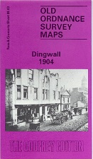
- Ross & Cromarty 88.03 Dingwall 1904 - published 1991, intro by A.A.Woodham
 Most maps in the Godfrey Edition are taken from the 25 inch to the mile map and reduced to about 15 inches to the mile.
For a full list of Scottish maps, return to the Scotland page
You can order maps direct from our On-line Mapshop.
This list shows all our maps for the area. We try to keep a full range in print but inevitably some titles fall out of print from time to time.
These are noted in our On-line Mapshop.
Most maps in the Godfrey Edition are taken from the 25 inch to the mile map and reduced to about 15 inches to the mile.
For a full list of Scottish maps, return to the Scotland page
You can order maps direct from our On-line Mapshop.
This list shows all our maps for the area. We try to keep a full range in print but inevitably some titles fall out of print from time to time.
These are noted in our On-line Mapshop.
Alan Godfrey Maps, Prospect Business Park, Leadgate, Consett, DH8 7PW. Tel 01207 583388
The Godfrey Edition / sales@alangodfreymaps.co.uk / 17 Nov 2016