Old Ordnance Survey Maps of Bromley
We have good coverage for the London Borough of Bromley. This was formed in 1965 from the merger of the Municipal Boroughs of Beckenham and Bromley, Orpington and Penge Urban Districts, and part of Chislehurst & Sidcup Urban District.
The village of Knockholt was later transferred back to Kent. For a summary of the county's
local government history visit This Page.
All maps are available from our On-line Mapshop.
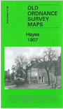
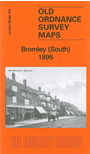
The following titles are all taken from the OS 25" maps and reduced to a scale of approximately 14 inches to the mile. Areas of Bromley are covered in both our
Kent and London series. Each map covers an area of a mile and a half by one mile, and includes an introduction.
 These are the principal maps for the London Borough of Bromley in our Kent series:
 These are the principal maps for the London Borough of Bromley in our London series:
 Most maps in the Godfrey Edition are taken from the 25 inch to the mile map and reduced to about 15 inches to the mile.
For a full list of English maps, return to the England page
You can order maps direct from our On-line Mapshop.
This list shows all our maps for the area. We try to keep a full range in print but inevitably some titles fall out of print from time to time.
These are noted in our On-line Mapshop.
Most maps in the Godfrey Edition are taken from the 25 inch to the mile map and reduced to about 15 inches to the mile.
For a full list of English maps, return to the England page
You can order maps direct from our On-line Mapshop.
This list shows all our maps for the area. We try to keep a full range in print but inevitably some titles fall out of print from time to time.
These are noted in our On-line Mapshop.
Alan Godfrey Maps, Prospect Business Park, Leadgate, Consett, DH8 7PW. Tel 01207 583388
The Godfrey Edition / sales@alangodfreymaps.co.uk / 3 November 2016