
 Here are the details of maps for Bromley (NW):

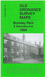
We have published just the one map for this area, which covers the northwestern part of Bromley, and eastern part of Beckenham. Coverage runs from Beckenham Cricket Ground eastward to Bromley College, and from Beckenham Lane and Shortlands House northward to Beckenham Place.
Features include Ravensbourne station, Bromleyhill, Bromley Cemetery, western part of Plaistow, Beckenham Place, Christ Church, Bromley Park area etc. On the reverse we include a 1906 directory of Bromley, entries A-C.
The map links up with London Sheets 146 Beckenham to the west, 148 Bromley North to the east and 152 Shortlands to the south. The map also links up with our Kent series map for Bromley.
 Follow this link for a complete list of our London maps .