Old Ordnance Survey Maps of Beeston


We have published more than 2,000 maps in our series of Old Ordnance Survey Map reprints, including a major group for the Leeds area. The maps are highly detailed. They are taken from the OS 1:2,500 (or 25 inch) maps and reduced to about 15 inches to the mile. Each covers an area of a mile and a half by a mile. They show streets with individual houses, tram tracks, railway tracks and even signals, factories, wharves and such details as fountains and water troughs. They will provide hours of fascination for historians and genealogists. The maps are neatly folded and each includes a specially written introduction to the area. Maps can be purchased on our On-line Mapshop where further information about titles is given. Or visit The Index Page for a full list to the series and details of Prices.


Here are the details of maps for Beeston:

  • Yorkshire Sheet 218.09 Beeston & Beeston Hill 1905 - published 2002; introduction by G C Dickinson

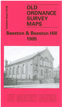
    This detailed map covers the Beeston area of south Leeds. The right hand third of the map is very built up with the terraces and back-to-back houses of Beeston Hill, extending south to Cross Flatts Park. Coverage then extend west along Elland Road - with the original football ground - and Beeston Road, the latter leading to the village of Beeston itself. Here features include Beeston Hall, St Mary's church, St Anthony's Padua chapel, station (on the GNR West Yorkshire Railway), Windmill Hill, Crow Nest Farm. Other features on the map include Beeston Near Royds, Beeston Royds Mill, Crow Nest Tannery, Manor Pit, Islington, Beggars Hill, Brick & Tile Works, Cross Flats, tramways, Holbeck Cemetery, Baron Close Brick Works. On the reverse we include street directory entries for Beeston Road, Cambrian Road, Malvern Road, Tempest Road. Gordon Dickinson's introduction gives an invaluable insight into the development of the area.


    The map links up with Sheets 218.05 Holbeck to the north, 218.10 Hunslet to the east.


    Follow this link for a complete list of our Bradford and Leedsarea maps; or here for the whole Yorkshire series.

    You can order maps direct from our On-line Mapshop. For other information and prices, and other areas, go to The Index Page.


    Maps in the Godfrey Edition are taken from the 25 inch to the mile map and reduced to about 15 inches to the mile. For a full list of maps for England, return to the England page.

    Alan Godfrey Maps, Prospect Business Park, Leadgate, Consett, Co Durham, DH8 7PW / godfreyedition@btinternet.com / 8 August 2007