
 Here are the details of maps for Worcester (NE):

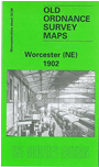
This detailed map covers the NE quarter of Worcester, with coverage stretching from Foregate Street eastward to Elbury Hill, and from Lowesmoor northward to Astwood Cemetery.
A major feature of the map is the railway coverage which includes Foregate Street station, the northern part of Shrub Hill station, engine sheds, loco and wagon repairing works, sidings, the Tunnel Loop Line, Tunnel Junction, Rainbow Hill Junction, Sheet Sheds etc. Other features include Shrub Hill Engineering Works, Shire Hall, Lansdowne Terrace, St Mary Magdalene church, gas works, Vulcan Iron Works, Newtown, Merriman's Hill, Gregory's Mill (disused), Worcester & Birmingham Canal, Rainbow Hill area, Portefields Farm, Ronkswood House, Brickfields Farm etc. On the reverse we include a selection of street directory entries, incl Arboretum Road, Astwood Road, Chesnut Walk, Foregate Street, Lowesmoor, Middle Street, Rainbow Hill, Sansome Place/Street/Walk, Shrub Hill Road, Tunnel Hill.
The map links up with sheets 33.03 Worcester NW to the west and 33.08 Worcester SE to the south.