Old Ordnance Survey Maps of Birmingham

  • These detailed maps normally cover an area of about one and a half miles by one mile. Each map includes an introduction.
  • They are available through our On-line Mapshop

  • Here are the details of maps for King's Norton:

  • Worcs Sheet 10.12 King's Norton 1903 - published 2003; intro by Alan Godfrey. ISBN.978-1-84151-573-1

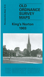
    This detailed map covers most of the village of King's Norton and extends eastward to Walker's Heath and Moundsley Hall.

    Features include Worcester & Birmingham Canal, junction with Stratford Canal, village centre, The Green, St Nicholas church, Hurst Mill, Wychall Rolling Mill, Sherborne Mill (at top of map), Broad Meadow, Walker's Heath, Headley Fields Farm, Moundsley Hall, Icknield Street etc. On the reverse we include a commercial directory of King's Norton in 1907.

    The map links up with Worcestershire sheets 10.08 Lifford to the north, 10.11 Northfield to the west.


  • For a full list of maps of Birmingham, please go to the Birmingham page.
  • You can order maps direct from our On-line Mapshop. For other information and prices, and other areas, go to The Index Page.
  • Maps in the Godfrey Edition are taken from the 25 inch to the mile map and reduced to about 15 inches to the mile. For a full list of maps for England, return to the England page.
    Alan Godfrey Maps, Prospect Business Park, Leadgate, Consett, Co Durham, DH8 7PW / sales@alangodfreymaps.co.uk / 18 January 2018