Old Ordnance Survey Maps of Birmingham

  • These detailed maps normally cover an area of about one and a half miles by one mile. Each map includes an introduction.
  • They are available through our On-line Mapshop

  • Here are the details of maps for Northfield:

  • Worcs Sheet 10.11 Northfield (South) 1903 - published 2003; intro by Alan Godfrey. ISBN.978-1-84151-546-5

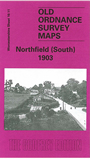
    This detailed map covers most of Northfield, and extends southward to Turves Green.

    Features include Midland Railway with Northfield station, St Lawrence's church, Moat Farm, Quarry House, Hawkesley Mill Farm, Turves Green Farm, Staplehall Farm, Wychall Farm, part of Wychall Reservoir. On the reverse we include a directory of private residents of Northfield, plus a timetable for the Redditch-Birmingham line in 1916.

    The map links up with Worcestershire sheets 10.07 Northfield N to the north, 10.12 Kings Norton to the east.


  • For a full list of maps of Birmingham, please go to the Birmingham page.
  • You can order maps direct from our On-line Mapshop. For other information and prices, and other areas, go to The Index Page.
  • Maps in the Godfrey Edition are taken from the 25 inch to the mile map and reduced to about 15 inches to the mile. For a full list of maps for England, return to the England page.
    Alan Godfrey Maps, Prospect Business Park, Leadgate, Consett, Co Durham, DH8 7PW / sales@alangodfreymaps.co.uk / 18 January 2018