
 Here are the details of maps for Northfield (North):

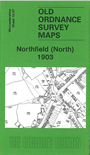
This detailed map covers an area southward of Birmingham that includes the northern part of Northfield. Coverage stretches from Griffins Brook Farm southward to Bunbury's Road.
This was a largely rural area in 1903, with just two principal thoroughfares: the Bristol Road, which runs diagonally down the centre of the map, and Bunbury Road which runs to the east. Features include The Woodlands, Haygreen Farm, Street Farm, Bell Inn, Lower Tinker's Farm, Middleton Hall, Manor Farm, a few villas and a few terraces near the main roads. On the reverse we include a commercial directory of Northfield in 1907.
The map links up with Worcestershire sheets 10.03 Griffins Hill to the north, 10.08 Lifford to the east, and 10.11 Northfield South to the south.