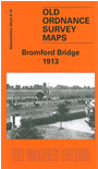
Warwickshire Sheet 8.15 Bromford Bridge 1913 - published 2004; intro by Roger Lea. ISBN.978-1-84151-654-7 
This detailed map covers an area on the NE side of Birmingham which was still largely undeveloped in 1913. The main feature is Birmingham Race Course, where features even include the jumps and winning post. Other features include part of Castle Bromwich Golf Course,
Bromford with a few streets partly laid out, Ashold Sewage Farm, Eversley House, Midland Railway with Bromford Bridge station, Hope House. We include a directory of Castle Bromwich on the reverse.
The map links up with sheets 8.11 Erdington East to the north, 8.14 Gravelly Hill to the west, Ward End to the south.
For a full list of maps of Warwickshire, please go to the Birmingham page or (for areas outside Birmingham) to the Warwickshire page.
You can order maps direct from our On-line Mapshop.
For other information and prices, and other areas, go to The Index Page.
Maps in the Godfrey Edition are taken from the 25 inch to the mile map and reduced to about 15 inches to the mile.
For a full list of maps for England, return to the England page.
Alan Godfrey Maps, Prospect Business Park, Leadgate, Consett, Co Durham, DH8 7PW / sales@alangodfreymaps.co.uk / 18 January 2018

 Here are the details of maps for Bromford: