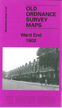
Warwicks Sheet 14.03 Ward End 1902 - published 2014; intro by Malcolm Nixon. ISBN.978-1-84784-775-1 
This detailed map covers the Ward End and north Stechford area, east of Birmingham.
Features include Hodgehill Common (in NE corner), Stechford Hall, Stechford BridgeWard End, Wardend Hall, St Margaret's church, Wardend House, Alumrock House, Alumrock Farm, Wardend Mill, Washwood Heath Road etc. A
1907 directory of Ward End is included on the reverse.
The map links up with sheets 8.15 Bromford Bridge to the north, 14.02 Saltley to the west, 14.07 Stechford 1902 to the south.
For a full list of maps of Warwickshire, please go to the Birmingham page or (for areas outside Birmingham) to the Warwickshire page.
You can order maps direct from our On-line Mapshop.
For other information and prices, and other areas, go to The Index Page.
Maps in the Godfrey Edition are taken from the 25 inch to the mile map and reduced to about 15 inches to the mile.
For a full list of maps for England, return to the England page.
Alan Godfrey Maps, Prospect Business Park, Leadgate, Consett, Co Durham, DH8 7PW / sales@alangodfreymaps.co.uk / 18 January 2018

 Here are the details of maps for Ward End