
 Here are the details of maps for Barking (East):

These three maps cover the eastern side of Barking. However, they are from different series, the 'Old' and 'New' Series Essex maps, and so the sheetlines are somewhat different. The 'New' Series maps link up more conveniently with the London Series, so we will discuss them first.
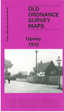
The Upney 1915 map captures the eastern side of Barking showing the streets off Longbridge Road gradually being built up: Cecil Avenue, Wilmington Gardens, Hulse Avenue etc. North of this is Barking Park. From here coverage extends a mile eastward into open country. The hamlet of Upney is bottom centre, with its Isolation Hospital, Manor Farm is to the NE. The LTS railway crosses the map west-east but no stations are shown. A directory listing of private residents in Barking in 1895 and 1920 is included.
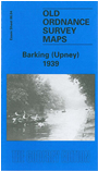
The Upney 1939 map provides a strong contrast, for the area is now largely built up, with many roads now developed off Longbridge Road. Upney station is now open, and other features include Lodge Avenue and streets to its east, Sandringham Road, Barking Park, isolation hospital (no longer very isolated!) Extracts from a 1933 directory are included to make this, with Tony Clifford's introduction an invaluable picture of the area as it developed across the years.
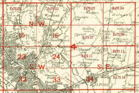
An index map showing the areas covered by this and adjacent maps is available here. The map links up with London Sheets 44 East Ham & Barking to the west, and Essex Sheets 78.16 Goodmayes to the north, 87.01 Parsloes to the east, 86.08 Barking SE to the south
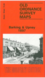
The Barking & Upney 1897 map is on different sheetlines, showing much the same area but stretching somewhat further west and south. This means that it does cover part of central Barking, including the station, Local Board Offices on East Street, Ripple Road, St Paul's Road and southward to Morley Road. Along the southern part of the map are Greatfield, Mowers House,, Eastbury House and the cemetery. The village of Upney is top centre. The map includes a commercial directory for Barking 1894.
Which of the three should you buy? If you are buying several maps, then the New Series maps link up neatly with others in the series (as listed above). If you are buying just one map, then the Barking & Upney 1897 has slightly busier coverage. Of course, we hope you will buy them all!