
 Here are the details of maps for Ilford & Goodmayes:

The two maps listed here are from different series, the 'Old' and 'New' Series Essex maps, and so the sheetlines are somewhat different. The 'New' Series maps link up more conveniently with the London Series, so we will discuss that first.
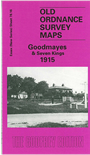
The Goodmayes 1915 map captures the eastern side of Ilford, extending to Goodmayes: an area that stretches from Sunnyside Road and Connaught Road eastward to Hazeldene Road and Colinton Road at Goodmayes; and from Cambridge Road and Seven Kings station southward to Mortlake Road and Longbridge Road. Features include the GER main line and Newbury Park Junction, St Mary's church, Ilford Cemetery, South Park, All Saints church Goodmayes, Goodmayes Farm. The southern half of the map is still quite rural, with Goodmayes Lane winding its way across the map, but the northern half is already lined with streets.
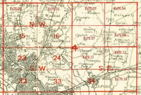
An index map showing the areas covered by this and adjacent maps is available here. The map links up with London Sheets 34 Ilford to the west, and Essex Sheets 78.12 Newbury Park to the north, 79.13 Becontree Heath to the east, and 86.04 Upney to the south.
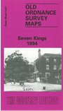
The Seven Kings 1894 map is on different sheetlines, showing an area somewhat to the north, although overlapping with the later map. This covers an area from Queen's Road and Sams Green eastward to Goodmayes Lodge and Goodmayes Lane; and from Ilford Cemetery northward to Wards Lane and Stump Cross. The area is far more rural than in the 1915 map, and the Newbury Park branch has not been built. Seven Kings station has not been opened. Features include Seven Kings Farm, Aldborough Cottages, St Mary's church, Cauliflower Road, Ash Grove.