
 Here are the details of maps for Ilford:

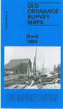
We have published two versions of this map, showing how the area changed across the years.
The maps capture Ilford when it was growing rapidly - the population rose from 10,913 in 1891 to 78,188 by 1911 - and many streets, especially in the SE area around Albert Road and Grosvenor Road are shown half built. Coverage extends west along Romford Road to Carlyle Road at Manor Park, and northward along Cranbrook Road to St Clement's church; features include the GER and station, Ilford Bridge, Gas Works, Ilford Hall, Ilford Lodge, River Roding, City of London Cemetery, Little Ilford. Extracts from early directories are included on the reverse.
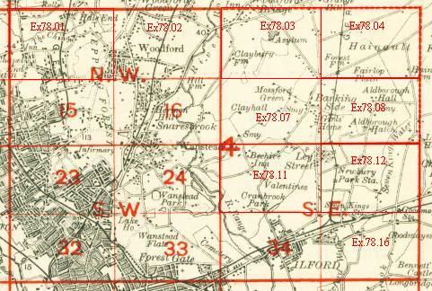
An index map showing the areas covered by this and adjacent maps is available here. The map links up with London Sheets 33 Wanstead Flats to the west, and 44 East Ham to the south; and Essex Sheets 78.11 Gants Hill to the north, 78.16 Goodmayes to the east.