Old Ordnance Survey Maps of Redbridge

  • These detailed maps maps normally cover an area of about one and a half miles by one mile. Each map includes an introduction. The Essex maps link up with those for London to form a major series for the Greater London area. They are available through our On-line Mapshop

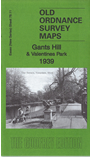
  • Here are the details of maps for north Ilford:

  • Essex (New Series) 78.11 Gants Hill & Valentines Park 1939 - published 2017; intro by Alan Godfrey. ISBN.978-1-78721-085-1

    This detailed map covers the area from Gants Hill southward to Valentines Park.

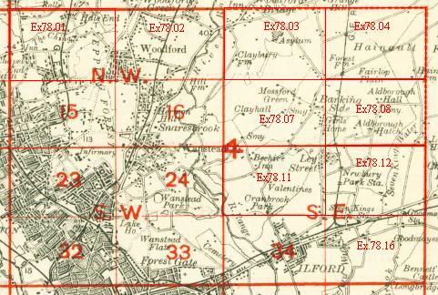
    Features include Valentines Park with The Mansion, cricket ground, The Lake, etc; Gants Hill area with Beehive pub, St George's church, etc; many streets now built up with 1930s housing. Other features include St Andrew's church, Wanstead Park Recreation Ground, St Margaret's church etc.

    An index map showing the areas covered by this and adjacent maps is available here. The map links up with Essex Sheets 78.07 Barkingside to the north, 78.08 Newbury Park to the east; and London sheets 24 Wanstead to the west and 34 Ilford to the south.


  • Follow this link for a list of our other Redbridge maps .
  • You can order maps direct from our On-line Mapshop. For other information and Prices, see Index Page.
  • Maps in the Godfrey Edition are taken from the 25 inch to the mile map and reduced to about 15 inches to the mile. For a full list of maps for London, return to the London page.
    The Godfrey Edition / sales@alangodfreymaps.co.uk / 21 Sept 2017