 Here are the details of maps for Teddington (East):

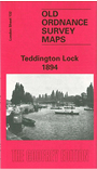
We have published just the one map for this area. The map covers the eastern part of Teddington, from Teddington station eastward, and from Waldegrave Park southward to Bushy Lodge and Holmesdale Road. It includes the High Street; Christ Church, St Mary's and St Alban's churches; Broom Road and a good stretch of the Thames, including Teddington Lock. The map also extends east of the river to include a portion of Ham parish, including St Andrew's church and, near the foot of the map, Albany Club. The map also includes a trade directory for Teddington.
The map links up with London Sheets 122 Twickenham to the north, 131 Teddington to the west, and 140 Kingston to the south.