Old Ordnance Survey Maps of Twickenham & Petersham


We have published more than 1,800 maps in our series of Old Ordnance Survey Map reprints, some 300 of them in the London area. The maps are highly detailed. They are taken from the OS 1:2,500 (or 25 inch) maps and reduced to about 15 inches to the mile. They show streets with individual houses, tram tracks, railway tracks and even signals, factories, wharves and such details as fountains and water troughs. They will provide hours of fascination for historians and genealogists. The maps are neatly folded and each includes a specially written introduction to the area. Maps can be purchased on our On-line Mapshop where further information about titles is given. For other information and Prices, see Index Page.


Here are the details of maps for Twickenham & Petersham:

  • London Sheet 122 Twickenham & Petersham 1894 - published 1991; introduction by Marilyn Scott

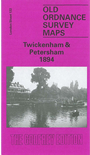
    We have published just the one version of this map. The map covers the eastern part of Twickenham, then reaches across the Thames to include Petersham and Ham on the Surrey side. Twickenham station is in the NW corner of the map, which then stretches eastward to Petersham and part of Sudbrook Park, and southward to Ham. Features include Eel Pie Island, King Street, Church Street, St Mary's church, Oak Lane Cemetery, Orleans House in Twickenham; National Orphans Home and Manor House in Ham; and Bute House, St Peter's church, Douglas House in Petersham. There are street directories for Arragon Road, Church Street, Grosvenor Road, King Street, London Road, Orleans Road, Petersham Road, Queen's Road.

    An index map showing the areas covered by this and adjacent maps is available here. The map links up with London Sheets 110 Richmond to the north, 121 West Twickenham to the west, 132 Teddington Lock to the south.


    Follow this link for a complete list of our London maps .

    You can order maps direct from our On-line Mapshop. For other information and Prices, see Index Page.


    Maps in the Godfrey Edition are taken from the 25 inch to the mile map and reduced to about 15 inches to the mile. For a full list of maps for London, return to the London page.

    The Godfrey Edition / godfreyedition@btinternet.com / 22 August 2005