
Old Ordnance Survey Maps of Shropshire
These detailed maps normally cover an area of about one and a half miles by one mile. Each map includes an introduction.
They are available through our On-line Mapshop
 Here are the details of maps for Lawley:
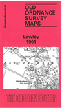
Shropshire Sheet 43.02 Lawley 1901 - published 1991; intro by Barrie Trinder. ISBN.978-0-85054-388-9 
This detailed map of Lawley is double-sided for maximum coverage. The main maps features include Lawley House, Lawley Farm, Heath Hill, Dawleybank Sunday School, Bulls Head Public House and the Cemetery. There are many sites of Collieries and Coal Shafts listed on this map. The GWR railway runs through the centre map (north to south) and shows Lawley Bank Station. On the reverse we have an extract from map 43.01 (to the west of this map) which includes Limekiln Wood, Black Hayes, Birch Coppice and Huntington.
This map links up with Shropshire Sheet 36.14 Ketley to the North, 36.15 Oakengates (South) to the North-East, 43.03 Dawley to the East and 43.06 Horsehay to the South
Follow this link for a complete list of our Shropshire or Telford maps.
You can order maps direct from our On-line Mapshop.
For other information and prices, and other areas, go to The Index Page.
Maps in the Godfrey Edition are taken from the 25 inch to the mile map and reduced to about 15 inches to the mile.
For a full list of maps for England, return to the England page.
The Godfrey Edition / sales@alangodfreymaps.co.uk / 30 January 2018