
Old Ordnance Survey Maps of Shropshire
These detailed maps normally cover an area of about one and a half miles by one mile. Each map includes an introduction.
They are available through our On-line Mapshop
 Here are the details of maps for Malins Lee:
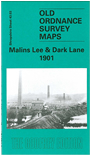
Shropshire Sheet 43.03 Malins Lee & Dark Lane 1901 - published 2002; intro by Barrie Trinder. ISBN.978-1-84151-439-0 
This detailed map of Malins Lee covers the area to the west of Lawley and as far as Dark Lane and Randlay. Features on the map include Malins Lee House and Hall, St Leonards Church, Hollinswood Junction, Malins Lee Station, Randlay Brick Works, Dark Lane Row, Brick Works, Spout House and many collieries are named on the map. On the reverse, we have an extract from the Coalport Branch Railway Timetable, and an extract from a directory for the area.
This map links up with Shropshire Sheet 43.02 Lawley to the West, 36.14 Ketley to the North-West, 36.15 Oakengates (South) to the North, 43.06 Horsehay to the South-West and 43.07 Dawley Magna to the South.
Follow this link for a complete list of our Shropshire or Telford maps.
You can order maps direct from our On-line Mapshop.
For other information and prices, and other areas, go to The Index Page.
Maps in the Godfrey Edition are taken from the 25 inch to the mile map and reduced to about 15 inches to the mile.
For a full list of maps for England, return to the England page.
The Godfrey Edition / sales@alangodfreymaps.co.uk / 30 January 2018