
Old Ordnance Survey Inch to the Mile Maps
These maps normally cover an area of about 18 miles by 12 miles and are especially good at showing railways, roads and canals, and at giving
a broad view of a wider area. Each includes an introduction and a more detailed map of a small town or village.
They are available through our On-line Mapshop
 Here is information about Sheet 352:
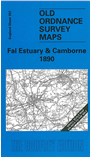
One Inch Sheet 352 Fal Estary & Camborne 1890 - published 2000; intro by Kim Cooper.ISBN.978-1-84151-162-7
This map covers the area of west Cornwall from Camborne eastward to Truro, and southward to Falmouth Bay. On the reverse is a detailed map of
Praze-an-Beeble, together with a short directory. For transport historians the map shows part of the branch to Helston, and the mineral branches to Portreath.
It is not possible to list the many hamlets, farmsteads and other topographical features shown on these maps. However, you may find it useful if we list the towns and
principal villages or church parishes that are included on this map:
Cornwall: Budock, Camborne, Crowan, Falmouth, Feock, Gerrans, Gwennap, Illogan, Kea, Kenwyn, Lamorran, Mabe, Merther, Mylor,
Penryn, Perranarworthal, Philleigh, Probus, Redruth, Ruan Lanihorne, St Anthony in Roseland, St Clement, St Day, St Gluvias, St Just in Roseland,
St Mawes, St Michael Penkevil, Stithians, Tregavethan, Truro, Wendron.
Index maps are available showing the areas covered by the Inch to the Mile maps. Go to This page
You can order maps direct from our On-line Mapshop. For a full list of Inch to the Mile maps go to the Inch to the Mile page,
where you will also find details of prices. For information on the rest of the series, go to The Index Page.
Alan Godfrey Maps, Prospect Business Park, Leadgate, Consett, Co Durham, DH8 7PW / sales@alangodfreymaps.co.uk / 16 April 2011