We have published more than 2,000 maps in our series of Old Ordnance Survey Map reprints, including a small group in Cornwall. The maps are highly detailed. They are taken from the OS 1:2,500 (or 25 inch) maps and reduced to about 15 inches to the mile. Each covers an area of a mile and a half by a mile. They show streets with individual houses, tram tracks, railway tracks and even signals, factories, wharves and such details as fountains and water troughs. They will provide hours of fascination for historians and genealogists. The maps are neatly folded and each includes a specially written introduction to the area. Maps can be purchased on our On-line Mapshop where further information about titles is given. Or visit The Index Page for a full list to the series and details of Prices.
Here are the details of maps for Redruth:
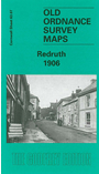
This detailed map covers Redruth, described by author Terry Knight as the 'Cornish heartland, predominantly a 19th century market town which became a metal mining centre of international significance'. Our map covers most of the town centre and the area to the south. Coverage extends from Fore Street southward to Church Coombe. Features in the town centre include station, Fore Street, West End, Chapel Street, Penryn Street, Station Hill, Jack Splat, Back Lane East, Albany Road, Clinton Road, Falmouth Road, Victoria Park, Sparnon, Fair Meadow, Trengweath House. The GWR main line runs through the map and part of the Tresavean Branch is shown. On the west side of the map are various hamlets: Carnbrea, Church Town, Church Coombe, part of Tarewaste. Other features include Redruth Workhouse, Wheal Uny, Wheal Union, Stream Works, South Carnbrea Mine, various old shafts. On the east side of the map a stretch of the Redruth & Chacewater Railway is shown; also Wheal Trefusis, Perseverance Mine, smelting works, Southgate Street. We include extracts from a 1910 directory on the reverse.
Follow this link for a complete list of our Cornwall Series maps.
You can order maps direct from our On-line Mapshop. For other information and prices, and other areas, go to The Index Page.
Maps in the Godfrey Edition are taken from the 25 inch to the mile map and reduced to about 15 inches to the mile. For a full list of maps for the South West, return to the South West page.
The Godfrey Edition / godfreyedition@btinternet.com / 29 May 2007