We have published more than 2,000 maps in our series of Old Ordnance Survey Map reprints, including a small group in Cornwall. The maps are highly detailed. They are taken from the OS 1:2,500 (or 25 inch) maps and reduced to about 15 inches to the mile. Each covers an area of a mile and a half by a mile. They show streets with individual houses, tram tracks, railway tracks and even signals, factories, wharves and such details as fountains and water troughs. They will provide hours of fascination for historians and genealogists. The maps are neatly folded and each includes a specially written introduction to the area. Maps can be purchased on our On-line Mapshop where further information about titles is given. Or visit The Index Page for a full list to the series and details of Prices.
Here are the details of maps for Penryn:
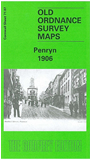
This detailed map covers the ancient town of Penryn, which was an important harbour as early as the time of Elizabeth I, long before the growth of Falmouth. Coverage includes the town centre, including Lower Street, The Praze, Commercial Road, Town Hall, Market Street, Broad Street, The Green, West Street, Church Road, St Gluvias church, College Farm, China Stone Mills, Custom House. A section of the GWR Falmouth Branch is included but not the station. The map extends east to cover Penryn Harbour, incl Sailors Creek, Ponsharden, Boyer's Cellors. Tehidy Terrace is in the bottom right corner. The map extends north to Bissom. On the reverse we include a directory of the town in 1910.
Follow this link for a complete list of our Cornwall Series maps.
You can order maps direct from our On-line Mapshop. For other information and prices, and other areas, go to The Index Page.
Maps in the Godfrey Edition are taken from the 25 inch to the mile map and reduced to about 15 inches to the mile. For a full list of maps for the South West, return to the South West page.
The Godfrey Edition / godfreyedition@btinternet.com / 29 May 2007